
More snow in the forecast for this weekend
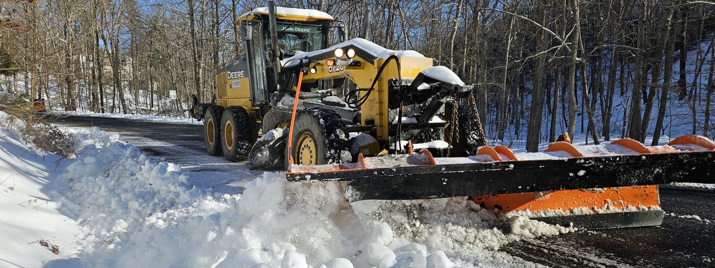
The Virginia Department of Transportation (VDOT) continues the daunting task of clearing Shenandoah Valley roads after Monday’s massive winter storm.
In a January 7, 2025 media release, VDOT Staunton District representatives noted a continued process of clearing ice and snow from area roadways despite high-winds, low temperatures and nightly re-freezing of surfaces.
The National Weather Service (NWS) recently released snowfall amount totals for the storm, which blanketed the area for nearly 36 hours.
An area of low pressure brought a widespread swath of 6 to 12″ of snow from the Alleghenies through the Shenandoah Valley across the DC metro and into Southern Maryland on January 5 through the early morning hours of January 7.
For many areas, this was the most snowfall in one location from a single snow event since January 2022, according to the NWS. Compiled snow total data is considered “unofficial” since, in many cases, data is from sources such as “CoCoRaHS” members, “Skywarn Spotters,” and broadcast media (and not “official” NWS technicians).
CoCoRaHS (pronounced KO-ko-rozz) is a volunteer network of backyard weather observers working together to measure and map precipitation (rain, hail and snow) in their local communities.
SKYWARN is a volunteer program with between 350,000 and 400,000 trained severe weather spotters. These volunteers help keep their local communities safe by providing timely and accurate reports of severe weather to the National Weather Service.
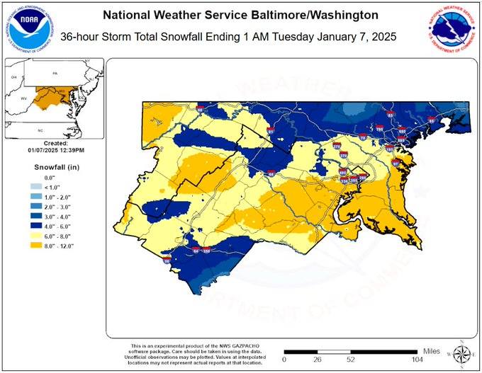
Collected data (inches, time, date recorded and by whom):
PAGE COUNTY
Honeyville 1 8.5 900 PM 1/06 Trained Spotter
Stanley 1 E 8.0 855 PM 1/06 Broadcast Media
Stanley 8.0 902 AM 1/06 Broadcast Media
Luray 7.5 730 PM 1/06 Public
Shenandoah 7.5 400 PM 1/06 Broadcast Media
Panorama 2 5.0 800 AM 1/06 Trained Spotter
ROCKINGHAM COUNTY
Dale Enterprise 8.0 630 PM 1/06 Trained Spotter
Harrisonburg 7.6 700 AM 1/07 CoCoRaHS
Massanutten 7.0 909 AM 1/06 Broadcast Media
Bridgewater 6.5 700 AM 1/06 CoCoRaHS
Harrisonburg 6.3 830 PM 1/06 Broadcast Media
Mt Crawford 6.0 800 AM 1/06 CoCoRaHS
Timberville 6.0 400 PM 1/06 Broadcast Media
Elkton 5.4 445 AM 1/06 Trained Spotter
Timberville 5.3 813 AM 1/06 Trained Spotter
Broadway 5.2 850 AM 1/06 Broadcast Media
A full list of January 5 – 7 snowfall totals for the NWS Washington DC area may be viewed HERE.
Additional snow is predicted for Friday, January 10, 2025.
The NWS forecast for the Shenandoah Valley predicts accumulation of less than one inch. Other outlets, however, are predicting as much as 3.” Southwest Virginia is expected to receive as much as 6.”
VDOT is responsible for snow removal on all state-maintained roads.
The Interstate Highway System and limited-access roadways are VDOT’s first priority. Primary roads (routes numbered 1 to 599) and major secondary routes (numbered 600 and up) with vital emergency and public facilities, or those with high-traffic volumes, are next cleared along with interstate and limited-access roadways as resources allow.
Low-volume secondary roads and subdivision streets will be treated after higher-priority routes are completed and additional resources are available.
VDOT reminds residents that roadways appearing wet in winter should be considered icy. During and immediately following winter storms, non-essential travel should be avoided. If travel is necessary, allow plenty of room for VDOT crews to work safely.
For frequently-updated road information, check the 511 website.
Apps for Virginia’s 511 system are also available for Android and iOS devices. 511 has traffic cameras, current crash locations, weather conditions and more. The public can sign-up for 511 alerts to be sent to their personal device. Roads with snow and ice conditions are marked minor, moderate, severe or closed.
The VDOT Staunton District serves the counties of Frederick, Shenandoah, Clarke, Warren, Page, Rockingham, Augusta, Highland, Rockbridge, Alleghany and Bath.